Arrowsmith, J R., McNally, K., and Davis, J., Potential for earthquake rupture and M 7 earthquakes along the Parkfield, Cholame, and Carrizo segments of the San Andreas Fault, Seismological Research Letters, 68, 6, 902-916, 1997.
Hilley, G. E., Arrowsmith, J R., and Stone, E. M., Using
microseismicity and surface offset data to define fault segment
boundaries along low friction faults, with an example from the
Cholame-Carrizo segment boundary along the San Andreas Fault,
Southern California, Bulletin of the Seismological Society
of America, 91, 427-440, 2001.
See also the web page associated with this paper: http://activetectonics.la.asu.edu/segmentation/
Stone, E.M., Grant, L., and Arrowsmith, J R., Recent rupture history of the San Andreas Fault southeast of Cholame in the northern Carrizo Plain, California, Bulletin of the Seismological Society of America, 92, 983-997, 2002.
Young, J. J., Arrowsmith, J R., Colini, L., Grant, L. B., and Gootee, B., 3-D excavation and measurement of recent rupture history along the Cholame segment of the San Andreas Fault, Bulletin of the Seismological Society of America: Special Issue on Paleoseismology of the San Andreas fault, 92, 2,670-2,688, 2002.
Runnerstrom, E. E., Grant, L. B., Arrowsmith, J R., Rhodes, D. D., and Stone, E. M., Displacement across the Cholame segment of the San Andreas Fault between 1855 and 1896 from cadastral surveys, Bulletin of the Seismological Society of America: Special Issue on Paleoseismology of the San Andreas fault, 92, 2,659-2,669, 2002.
Arrowsmith, Stone, and Grant SAF 1999 SCEC Annual Report:
Entire
report (PDF file; 20 Mb!)
Page
1
Page
2
Page
3
Page
4
Page
5
Beth's web page with some nice images from her thesis: http://activetectonics.la.asu.edu/Beth/AGUposter/
Arrowsmith and Grant SAF 2000 SCEC
proposal
SCEC Final Technical Report
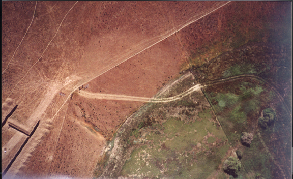
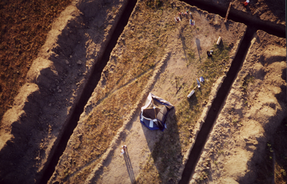
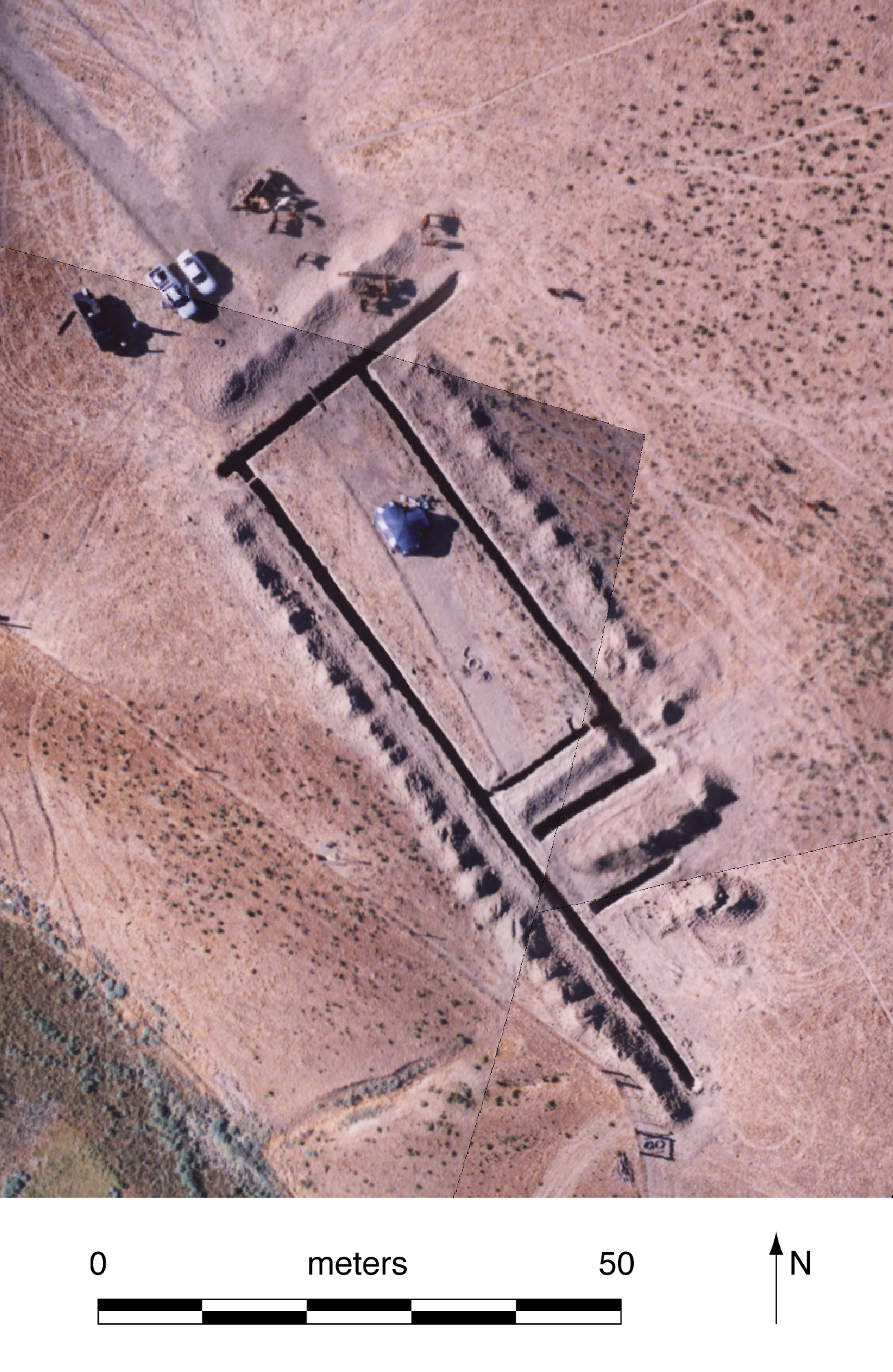
Here are some ground and kite
photos of the excavation on May 10 and 11, 2000:
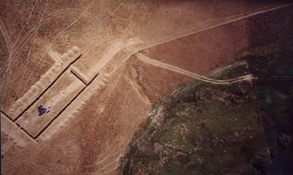
North is generally off to the left in these two photos. The smaller
trench toward the right is the 1999 trench. The two fault parallel trenches
are about 40 m long.

A major operation!
Special thanks to Scott Nowicki for his remote sensing help.
Here is the rectified photo mosaic of the kite photos from May 2000.
Here is the low resolution full image: ly4kitefulllores.jpg
Here is the high resolution full image: ly4kitefullhires.jpg
Here is the tif file: ly4kitemosaic.tif
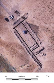
Here is the trench layout on 5_28_00:
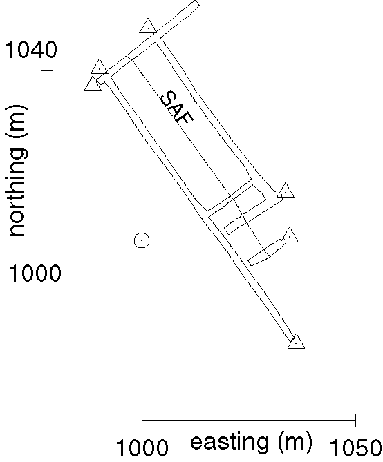
Here is the Illustrator 8 file: trenchzoom.ai
Here is a worksheet for surveying and reoccupying the network:
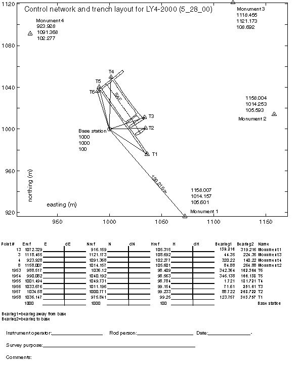
Here is the Illustrator 8 file: controlmap.ai