Topographic mapping of burnt and unburnt areas on the Carefree fire scar
Introduction
Our hypothesis is that the landscape should respond to the change in land cover due to the burn by increasing drainage density and other morphologic changes that should be measureable from the topography.
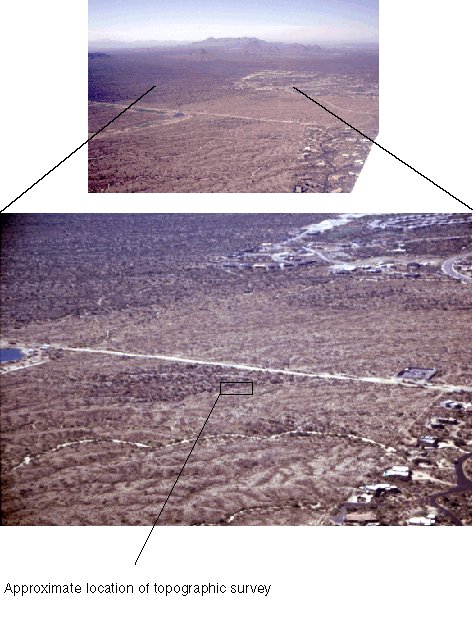
We chose the north edge of an island of unburned landscape within the "Carefree" fire scar. The figure below shows the approximate location from the air looking south-southeast. Note the clear delineation of the scar edge around the island and the main edge on the south.
Illustrator version of above
Data
These data were collected in July, 2001 using a Leica GPS Total station rented from SERVCO:
Surveyors Service Co
4317 N 16th St
Phoenix, AZ 85016
602-274-2052
$385 daily and $1904 week and $6480k/month
Nick Cournoyer
Mobile Number 480 225 4090
http://www.leica-geosystems.com/
Original dataset:
ASU_GPS_POINTS_NAD83.CSV
MATLAB topographic analysis
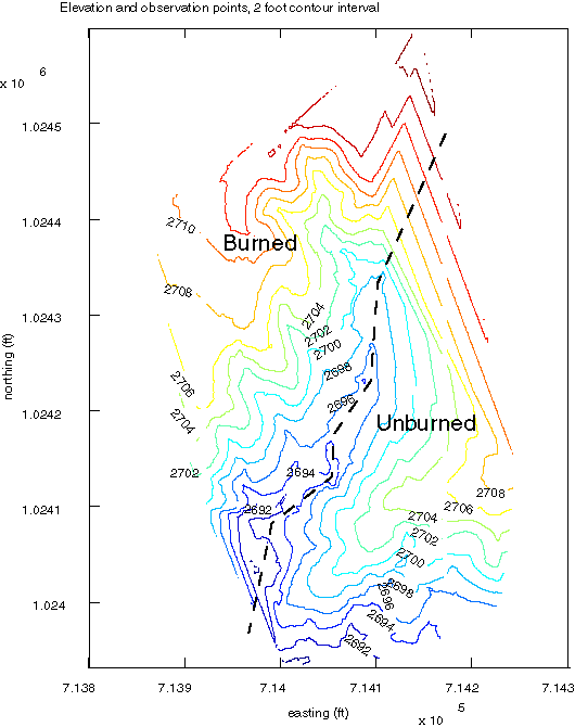
These data were gridded into a 200x200 grid (~60 cm/pixel) using a linear interpolation.
Filtered dataset:
filtered.txt
Script (make sure that this and filtered.txt are in the same directory):
topomapper.m
Grid:
Illustrator file of above
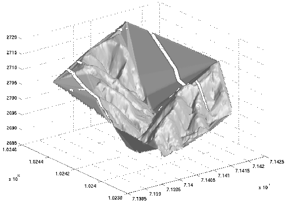
3D view of the surface looking toward the northeast. The fire edge is along the axis of the main drainage with unburned to the right (south). The planar portions of the surface are interpolated across no data areas, and the open strips are gridding artifacts.
TIF file of above
Return to Fires and Floods page
Pages maintained by Ramón Arrowsmith, Department of Geological Sciences, Arizona State University
last modified August 23, 2001