Images of active tectonics from the central Altyn Tagh fault, southern Xinjiang China
These views of the Altn Tagh fault zone are presented in series from east to west, starting at about 91.75 degrees east longitude to about 89.75 east longitude. All photos by Ramon Arrowsmith and Zack Washburn.
References:
Washburn, Z., Arrowsmith, J R., Forman, S. L., Cowgill, E., Wang, X. F., Zhang, Y. Q., and Chen, Z. L., Recent earthquake geology of the central Altyn Tagh Fault, China, Geology, in press, 2001.
and
Zack Washburn, M. S. thesis, Quaternary tectonics and earthquake geology of the central Altyn Tagh fault, Xinjiang, China: implications for tectonic setting and process along the northern margin of the Tibetan Plateau, Arizona State University, August, 2001.

Regional tectonic setting and location in Asia on GTOPO30 1 km digital topography.

Early version of fault trace map on CORONA photography from Washburn et al. The first three photos below are to the east of this map.

tiff format
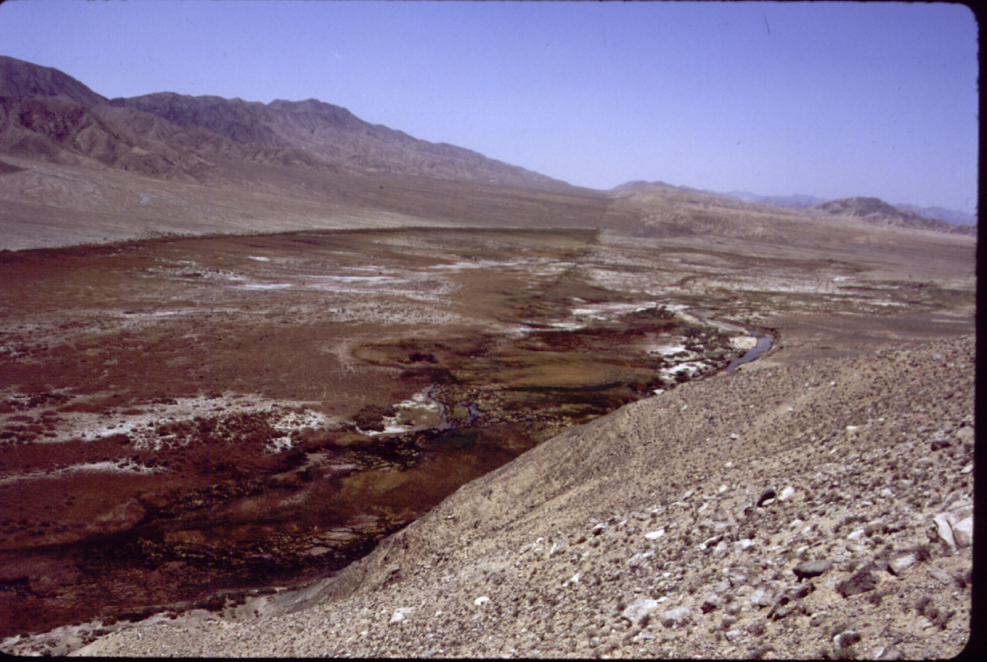
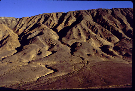
View to the west along the Altyn Tagh fault in the far eastern part of the Xorxoli Valley about 30 km east of the road to LaPeQian. The fault trace is marked by a mostly north facing scarp. It was probably constructed mostly by accretion of windblown sands and silts into the vegetation localized by springs just south of the fault trace.

tiff format
Multiply-stranded trace of the Altyn Tagh fault in the eastern Xorxoli Valley. This view shows the character of the fault zone in which deformation is distributed across several fault traces spanning about 100 m. The traces are evident as north-facing (right) scarps. View is to the west and a person is somewhere in there in the middle ground to the left for scale.
tiff format
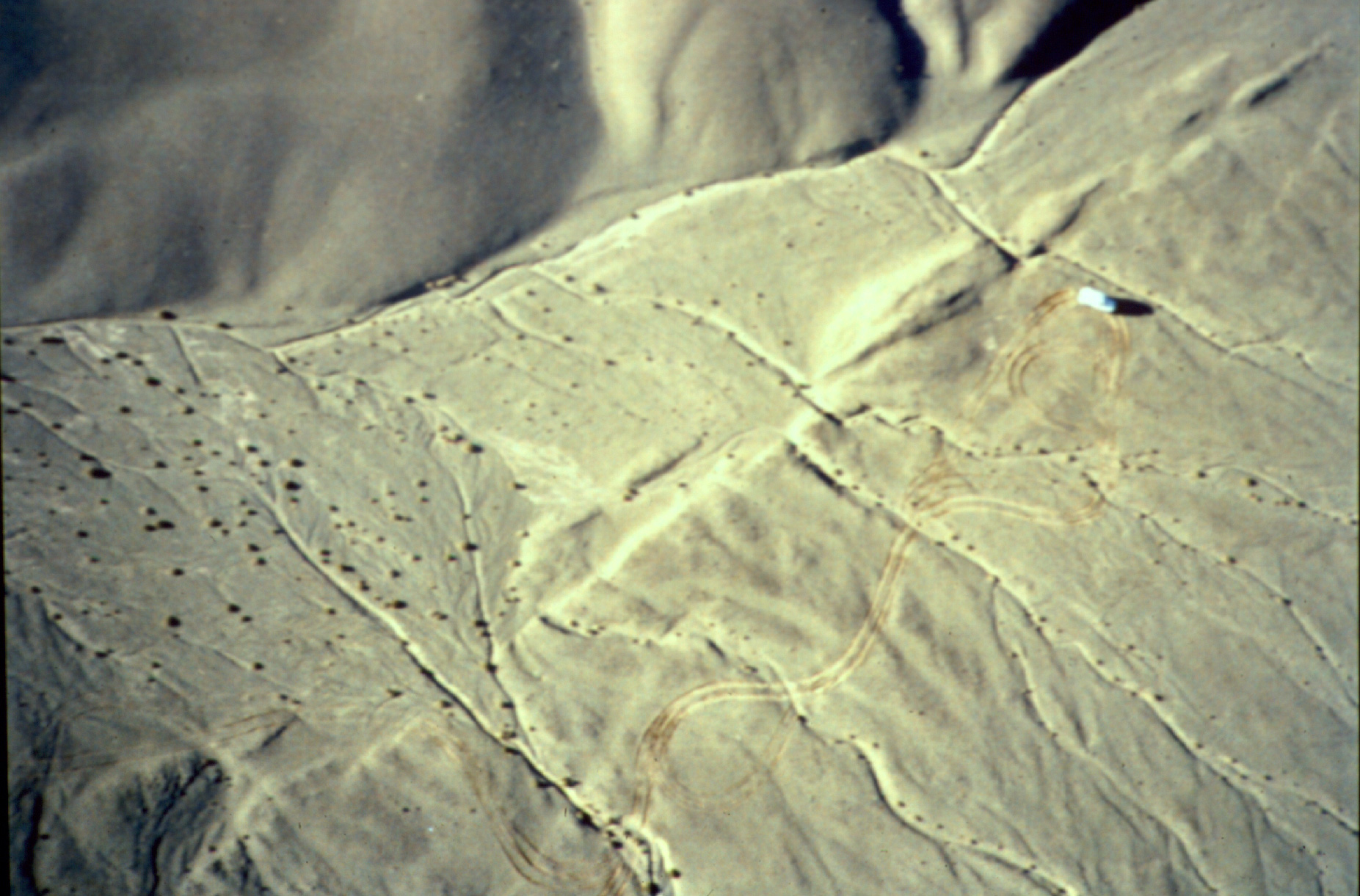
Kite photograph of the Atyn Tagh fault zone in the east-central Xorxoli Valley showing a high qualtiy 4.3 m left lateral offset just above (north) of the Landcruiser (5 m long). The discontinuous trace of the fault zone comprises 10-100 m long segments along some of which small pressure ridges are built (to the left of the Landcruiser), and others of which are buried by deposits younger than the last earthquake (several hundred years according to Washburn, et al.).
tiff format
Southwest view of the spectacular rupture zone in the GoBiLing--just west of the Xorxoli Valley at an elevation of about 3800 m. Here we found the best preserved and largest apparent single event offsets along the central Altyn tagh fault. The area also shows nice interaction features (pop-up structures) along the discontinuous, en echelon rupture traces and larger offsets.
tiff format
South view of large offset in the GoBiLing (to the left; looks like about 50 m, but is really only about 20 m because the down stream portion of the channel veers along the fault for a distance) and a single event offset (show in photograph below). There is a person near the small er offset for scale
tiff format
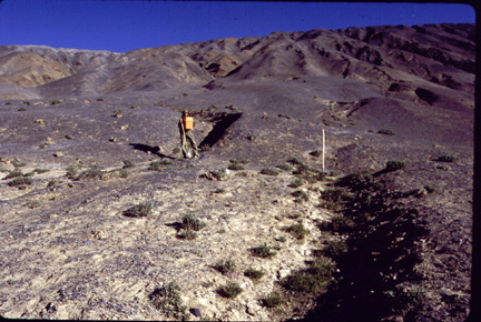
South view of Guillaume Dupont-Nivet (U. Arizona) standing at the intersection between a north draining stream and the Altyn Tagh fault in the GoBiLing. The portion where he stands was offset left laterally by about 7 m from channel marked by the shovel in the last earthquake (several hundred years ago, Washburn et al.). There are at least 3 more excellent quality offsets like this that record the 6-7 m offset in the last event in this area. It was apparently the largest offset along the fault for about 100 km to the east and west.
tiff format
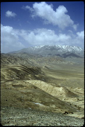
View to the west at the Ping Ding Shan, a flat topped mountain (literally) bounded on the southeast by a large normal fault escarpment that bridges a left step in the Altyn Tagh fault trace in the foreground and one on the Ping Ding Shan's south side (far left of this view). This group of mountains is west of the XorXoli and east of the Mangnei-Roquiang highway.
tiff format
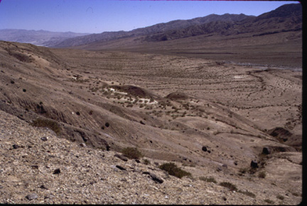
View to the east-south east along the Altyn Tagh fault zone in the area of the Kuel Sayi Vaelly just west of the Mangnei-Roquiang highway. The fault zone is marked by a series of en echelon traces with well develope deflected drainages and shutter ridges (evident in this view). This area was mapped by Eric Cowgill (UCLA) and Ramon Arrowsmith and colleagues in 1998.
Pages maintained by Ramón Arrowsmith, Department of Geological Sciences, Arizona State University
Last modified 9 September, 2001