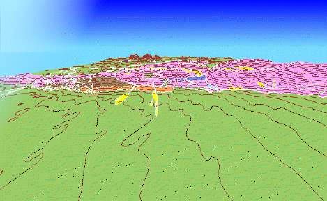
The Carrizo Project is currently exploring different visualization techniques of spacial data. Among these visulization techniques are remote isometric views of the structure, geology, contours and attributes, incorporation of SPOT photos as a background display for structure overlays, in field isometric views of particular geological/ topographical features of the area, and digital relief shading as a means of representing the topography on a map.The remote isometric visualization techniques under development help to highlight stratigraphy, thrusting, and folding of the area. Different views of the suface can be created from any angle and any distace from the study area. The geology can then be plotted on top of this surface. This type of visualization aides in the formulation of subsurface geologic conditions. In addition, structure overlayed on top of this surface can help identify the role of faulting in the area. As can be seen in the image produced below, data that is not conventionally posible to represent on a map can now be visualized.
The project is also exploring the creation and use of Digitally Shaded Relief Maps as a means of presenting elevation data. We have been able to create these types of maps and then overlay geologic units and structure on top of the map. For scales exeeding 1:100,000 we feel that this technique will replace the need for a spot photo base. However, the scales at which we are working are too large for the digital elevation data to serve as a substitute for high- resolution spot photography.Below is an example of a digitally shaded relief map of the study area. Structure and geologic units are not shown on the relief map.
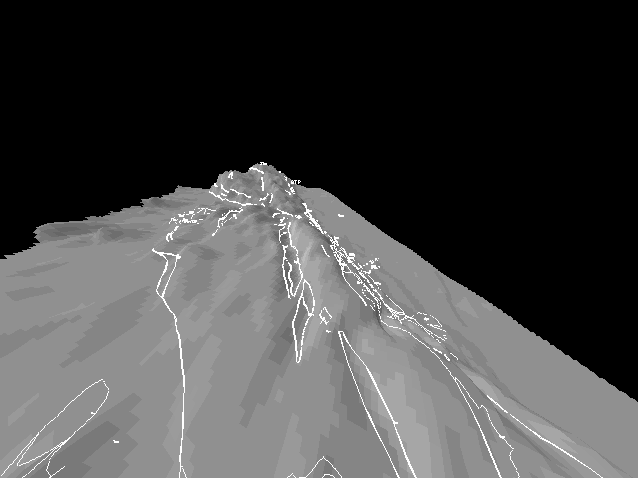
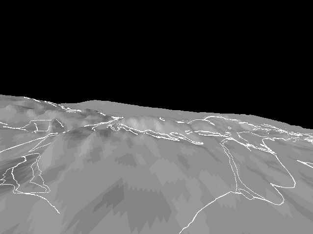
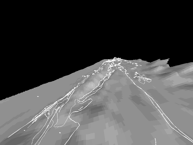
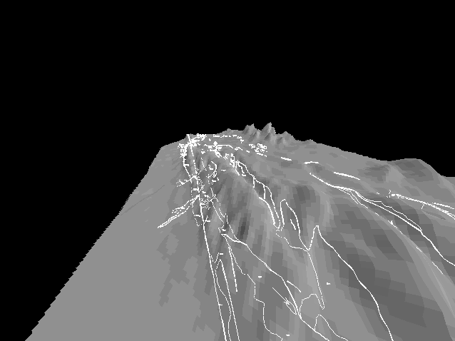
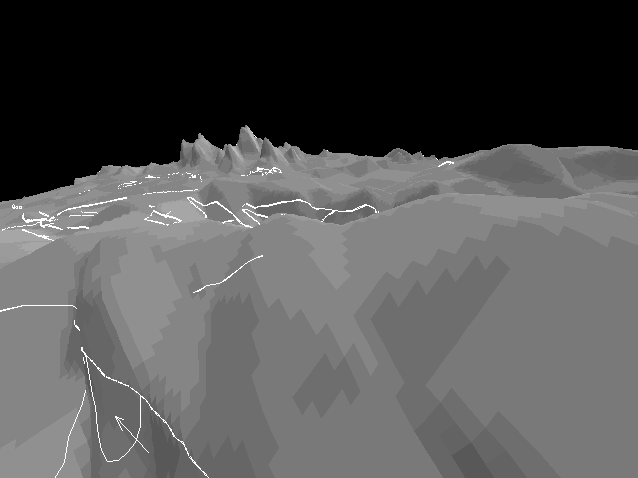
A new visualization tool developed by the project takes advantage of both isometric views and digitally shaded relief maps to produce realistic representations of the Carrizo Plain terrains. Triangulated Irregular Networks (TINs) were created from the existing USGS digital elevation models in order to provide a more realistic three dimentional surface model. Once these TINs were created, digitally shaded relief maps could be draped on top of this surface. The overall effect is an accurate terrain view on which geologic features may be overlayed.The following series of images is a pan around view of the Carrizo Plain. The first image was created at an azimuth of 220 degrees 1000 meters away from the surface at an altitude of 6 degrees. There is a 10X vertical exageration in the images. Each image's azimuth in incremented by 60 degrees.
In addition to remote isometric views, an in-surface isometric view was produced. 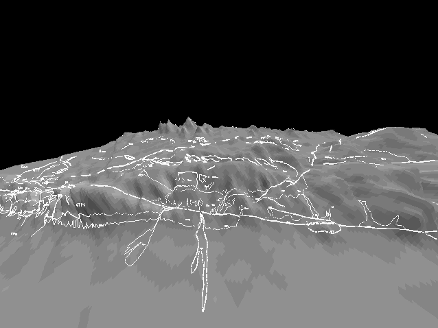
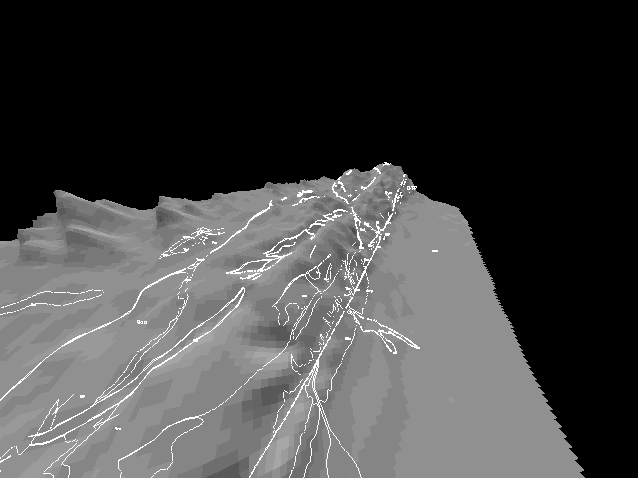
The viewfield is shown below:
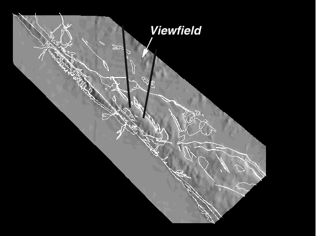
The following is the image:
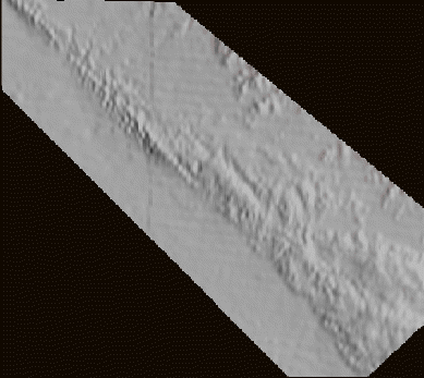
Another visualization technique the project is now developing is the incorporation of digitized SPOT photos into the mapping process. The group is currently using GPS systems to pinpoint exact real- world coordinates on the spot photo so that the distortion in the photo may be corrected. Then, these field data gathered will be used to warp the SPOT into a state plane projection. At the conclusion of the process, it is hoped that the SPOT photo may be used as a base for some of the maps being created with the GIS.The use of in field isometric views is currently being explored. These views wouldallow the reseach group to see the geology and structure from any vantage point on the surface of the study area. These views would be created based on 7.5 minute DigitalElevation Models (DEMs) supplied by the United States Geological Survey. It is hoped that these views could be used as overlays for photographs taken in the study area. For example, the pictures below represent three gullies in the Carrizo Plain. This technique would eventually allow the structure and geologic units to be outlined on top of the photograph, so that one may actually see where in the photograph the geologic units and structures are.


 Return to Tectonogeomorphology Project Home
Page
Return to Tectonogeomorphology Project Home
Page