| Name | Number | Beginning of record | T_R_S | Lat | Long | Elevation | Jurisdiction | Location |
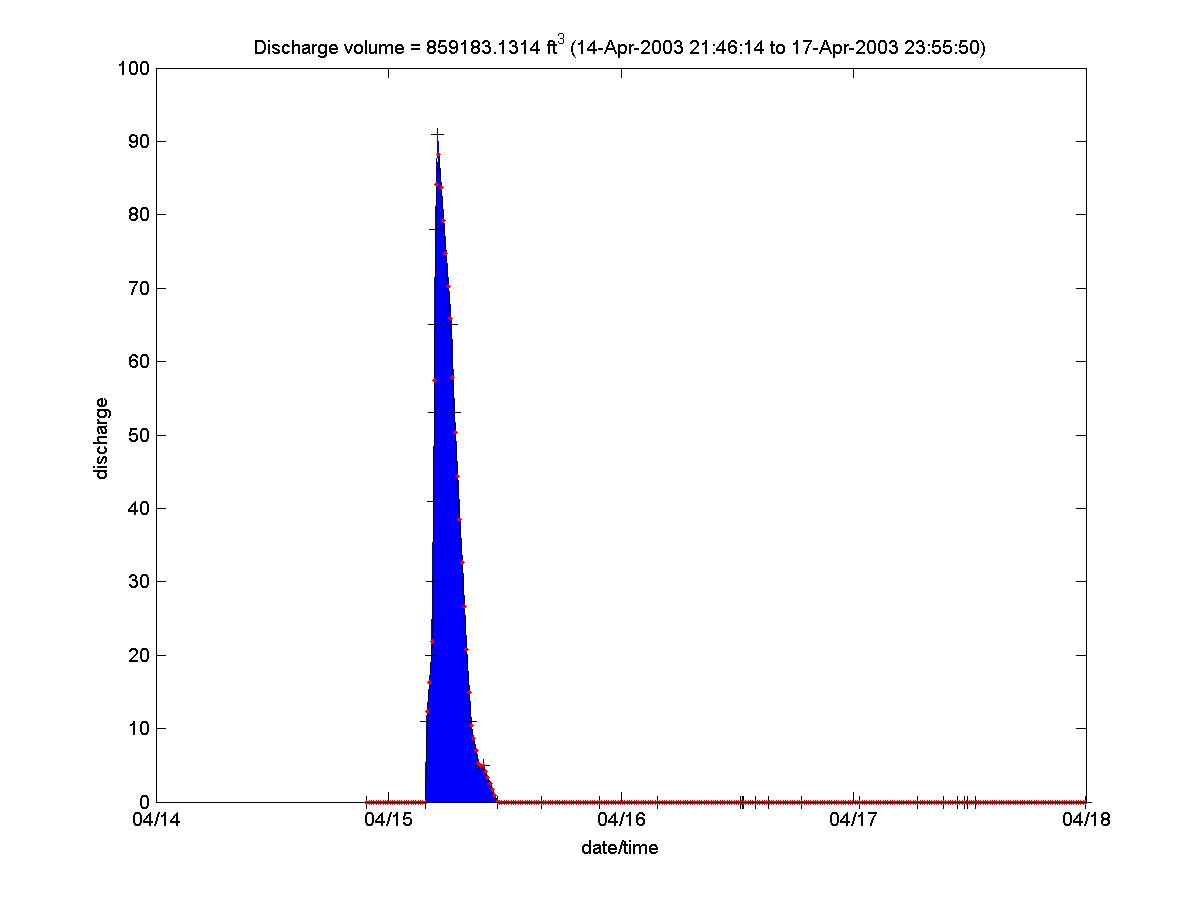
| IBW @ Indian Bend Rd. | 4613 | 3/27/1992 | 2N-4E-11 | 33 32 00 | 111 54 53 | 1071 | Scottsdale | On Indian Bend Wash just S. of Indian bend Rd. |
| IBW @ Indian School | 4618 | 11/26/1997 | 2N-4E-23 | 33 29 28 | 111 54 20 | 1235 | Scottsdale | Indian School Rd. at Hayden Road |
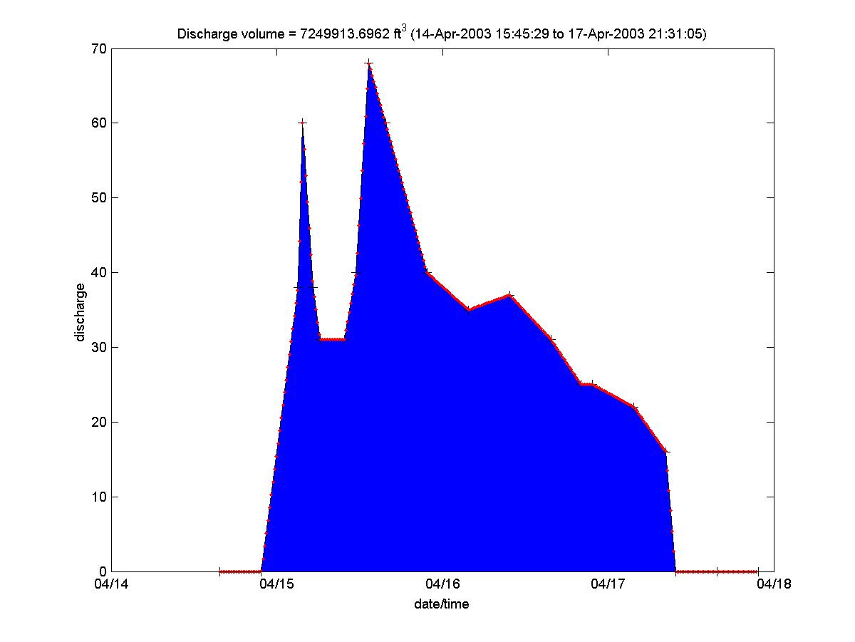
| IBW @ Interceptor | 4623 | 4/21/1994 | 2N-4E-12 | 33 31 57 | 111 53 55 | 1071 | Scottsdale | 1/4 mi. SW of Pima Rd. & Indian Bend Rd. |
| IBW @ McDonald Dr. | 4628 | 11/25/1997 | 2N-4E-11 | 33 31 15 | 111 54 08 | 1265 | Scottsdale | McDonald Drive at Hayden Road |
| IBW @ McKellips Rd. | 4603 | 5/21/1985 | 1N-4E-11 | 33 26 58 | 111 54 58 | 1187 | Scottsdale | On Indian Bend Wash 1/4 mi. South of McKellips |
| IBW @ Shea Blvd. | 4693 | 6/9/1998 | 3N-4E-29 | 33 34 56 | 111 58 08 | 1350 | Phoenix | Shea Blvd. At 52nd Street |
| IBW @ Sweetwater | 4643 | 12/27/1990 | 3N-3E-13 | 33 36 15 | 112 00 18 | 1400 | Phoenix | 1/2 mi. E of 32nd St. and Sweetwater Ave. |