Download 6Mb tiff file (used in Science News and Views)
As the population in southwestern cities such as Phoenix, Las Vegas and Tucson grows, housing is creeping out of the flat basin floors that attracted humans hundreds of years ago and moving onto the piedmonts of the surrounding mountain ranges. Intact piedmonts that are both unaltered and easily accessible are becoming increasingly rare and should be studied while they remain intact. There are still many unanswered geologic questions about these environments that will be easier to answer before developments cover this landscape. Research in a landscape targeted for develop allows for the interaction between scientific curiosity and practical societal needs.
Much of our research is conducted in the White Tank Mountains, west of Phoenix, that have served as a natural laboratory to investigate the geologic history, material, and surficial processes in a piedmont analogous to many rapidly developing areas in the desert Southwest. Research has focused on testing the hypothesis that satellite imagery in conjunction with field mapping can aid in identifying flood hazards and using cosmogenic dating to develop an absolute chronology for the area.
While piedmont environments lend themselves well to relative dating, a long-standing challenge for geomorphologists has been to determine numerical ages and refine geologic chronologies. A promising technique to address this need is the measurement of in-situ cosmogenic isotopes. Cosmogenic isotopes will improve the resolution of the geologic history of this area and aid in our understanding of the surface and subsurface processes acting in this environment.
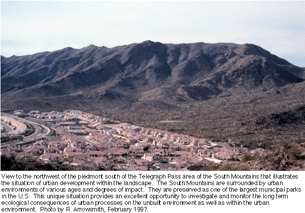
LTER and Globe photo showing the urban fringe
Download 6Mb tiff file (used in Science News and Views)
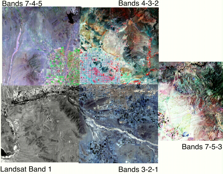
Different band combinations of Landsat imagery of the Phoenix Basin
Research with Prof.
Laura Mussachio from the School of Planning and Landscape Architecture:
To what extent have
geological patterns shaped the location and boundaries of the public open
space system of Phoenix?