Baja Home
Collaborators
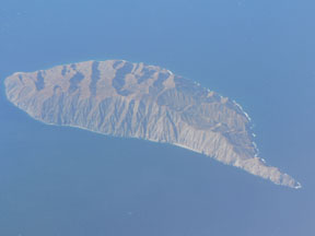
Spring 2007 Field work Data
Spring 2006 Field work Data
Spring 2006 Field work plan
December 2005 Recon Data
Project Publications
Data, Resources and Links
|
Rifting of continental lithosphere is a fundamental process in the formation and evolution of
continent margins. Rifts and passive margins are also of great societal importance because many
current global oil reserves, and the majority of recent large discoveries, are within these basins.
Despite the importance of rifts, we lack a full understanding of the processes that drive rifting,
the deformational patterns and mechanisms of extension, and the critical parameters that control
the transition from rift to drift deformation and localization of plate motion on the transform-spreading ridge system.
The roles of changing strain rates, lower-crustal flow, and strike-slip
partitioning in rift evolution have been emphasized in recent years. The Gulf of California is one
of the best places to study rifting because the plate boundary is actively forming, rift
segmentation has been well documented, there are major ongoing NSF MARGINS projects at crustal
to upper mantle scales, and it is practical to work there.
We propose to quantify rates of faulting at 101 to 105 time scales across the outer margin of the oblique-divergent plate boundary in the southwestern Gulf of California, by using GPS, traditional paleoseismology, and marine paleoseismology on faults from Loreto to Cabo San Lucas and offshore on the shallow marine shelf. Research will focus on faults that run from onshore to offshore. The research will address important processes during the rift to drift transition along the plate boundary with emphasis on strike-slip partitioning and why faulting continues after spreading ridges have formed. Specific questions to be addressed include: 1) To what extent is the plate margin strike-slip partitioned? Concentrating on two transects near Loreto and La Paz, what are the patterns and rates of faulting across the plate margin? 2) What is the cause of different magnitudes of strike-slip partitioning along two transects? Work to date suggests that the Loreto area has little or no partitioning while the La Paz area has significant partitioning. Where is the boundary between the two partitioning domains? 3) How has faulting evolved over time? Has faulting slowed and moved offshore (east) toward the main plate boundary since the late Pliocene? Is faulting slowing in last 130 ky? This research builds on recent work on the southern Baja California peninsula and islands. The research will (i) follow up on two GPS survey efforts that need additional campaigns to produce meaningful velocities; (ii) extend recent mapping and trenching along one active fault to 4-5 other faults; and (iii) quantify fault-slip rates and details of fault geometry on faults mapped in the past decade. The marine paleoseismology is critical as it will be the first detailed study of the offshore projections of 6-7 active faults and 4-5 faults wholly offshore. The CHIRP will perfectly compliment a recent crustal-scale seismic project that had two major transects across deeper parts of the Gulf of California, but did not image in less than 200 m water depth. The proposed research and the crustal-scale project will combine to complete two transects across the Gulf of California. With these data, all elements will be in place to address the major geodynamic questions for the plate boundary. |
| This project is supported by the US National Science Foundation |
