Parkfield Home
Paleoseismology and Geomorphology
Geologic Mapping and Structural Synthesis
3D Data Integration and Visualization
September 28, 2004 Parkfield Earthquake
Project Publications
Data, Resources and Links
![]()

Event Overview:
3D Visualization of Seismicity associated with this event - provided in VRML format as a demonstration of the capabilities of the Parkfield Unified Visualization Project. Note: The entire 2004 rupture is being surveyed by a USGS/California Geological Survey team (Mike Rymer, John Tinsley, and Jerry Treiman). Here is a link to some preliminary information from them: http://www.consrv.ca.gov/CGS/geologic_hazards/earthquakes/09282004_field_obs.htm Central Middle Mountain: A portion of our post-EQ field effort was focused on fracture mapping on Ted Gilbert's property on Middle Mountain. These data were contributed to the rupture survey being completed by the USGS/CGS team:
Below is our field map overlain with the shapefile of observation localities along the rupture: 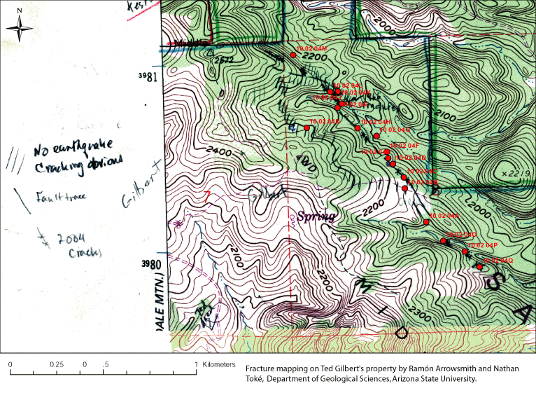
Downloads: Field Notes (Excel file): ArrowsmithParkfieldNotes.xls Zipped Shapefile (NAD83 UTM): ArrowsmithTokePKFnotes.zip Adobe Illustrator file of above map Detailed mapping with total station of rupture belt at Parkfield: Arrowsmith and Toké performed a total station survey of all fractures along an approximately 400 m long section of the rupture southeast of the Parkfield Bridge (see the above powerpoint 2004_Parkfield_Earthquake_EQM.ppt (115 MB) -- for details of the mapping and photographs keyed to the map). This section of the fault corresponds with a detailed paleoseismic study conducted by Toké during the summer of 2004. For more information on the paleoseismic results and an integration of the 2004 fracture mapping with the paleoseismology, see the Paleoseismology and Geomorphology page. 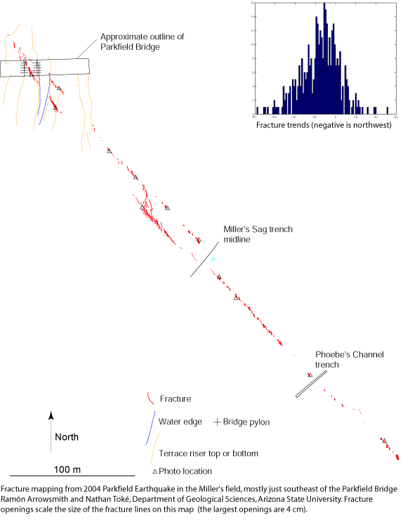
Downloads: Adobe Illustrator 10 version of above map Adobe Acrobat version of above map |
