Parkfield Home
Paleoseismology and Geomorphology
Geologic Mapping and Structural Synthesis
3D Data Integration and Visualization
September 28, 2004 Parkfield Earthquake
Project Publications
Data, Resources and Links
![]()

|
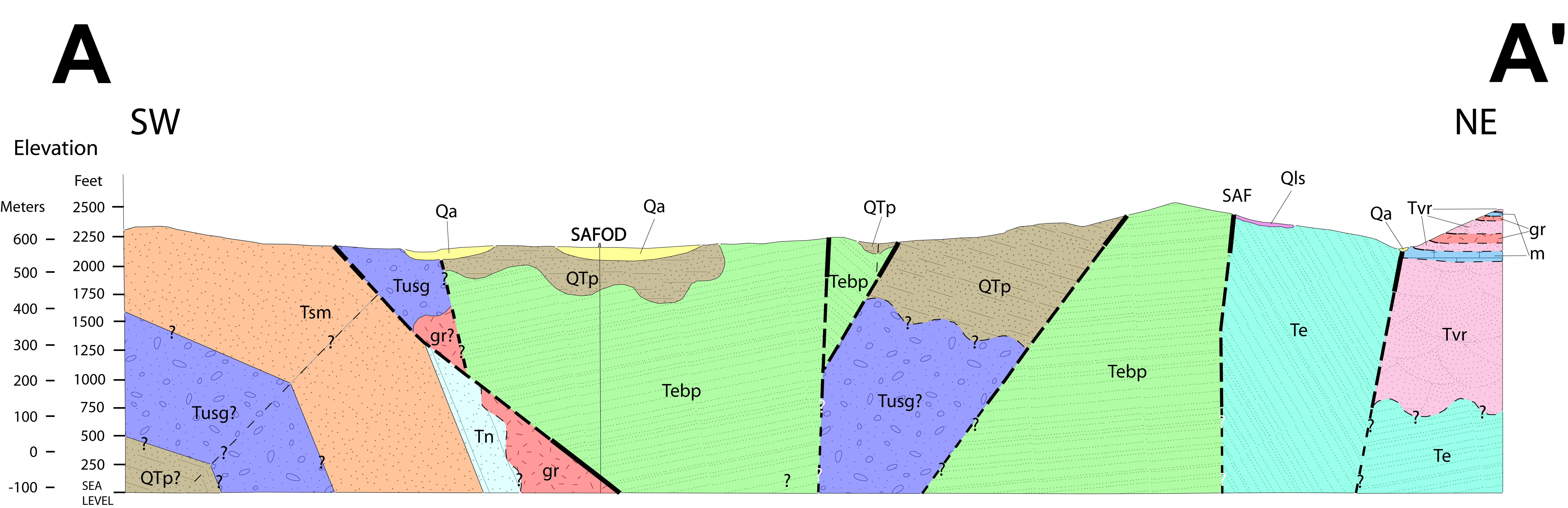
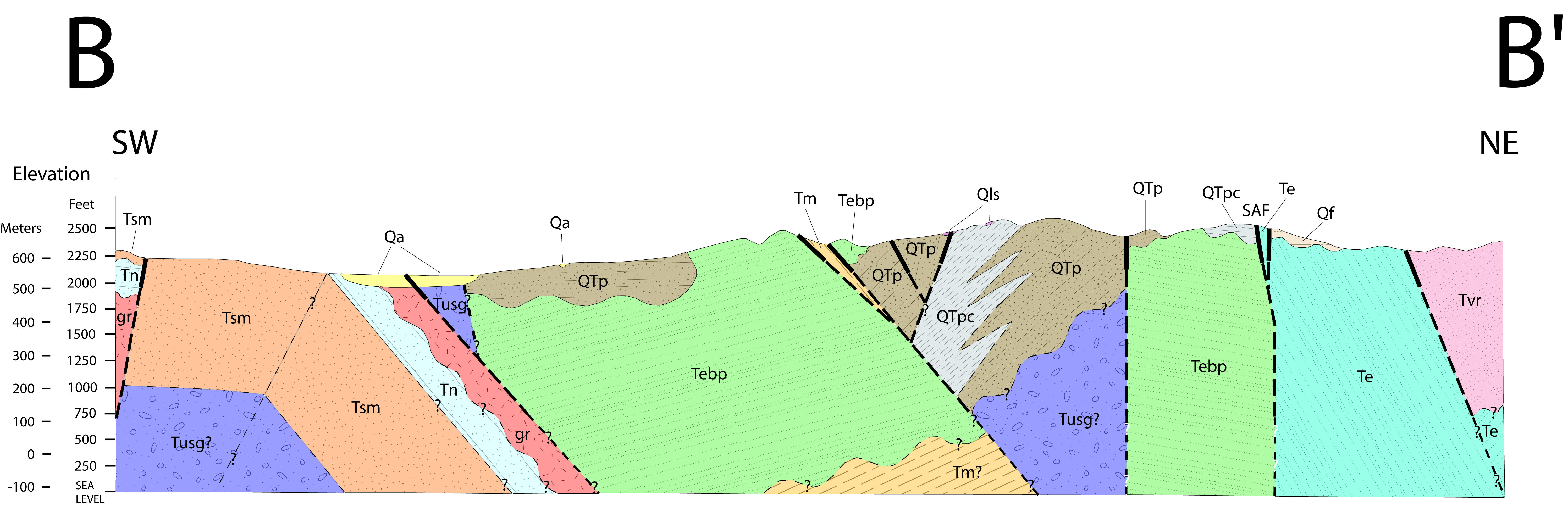
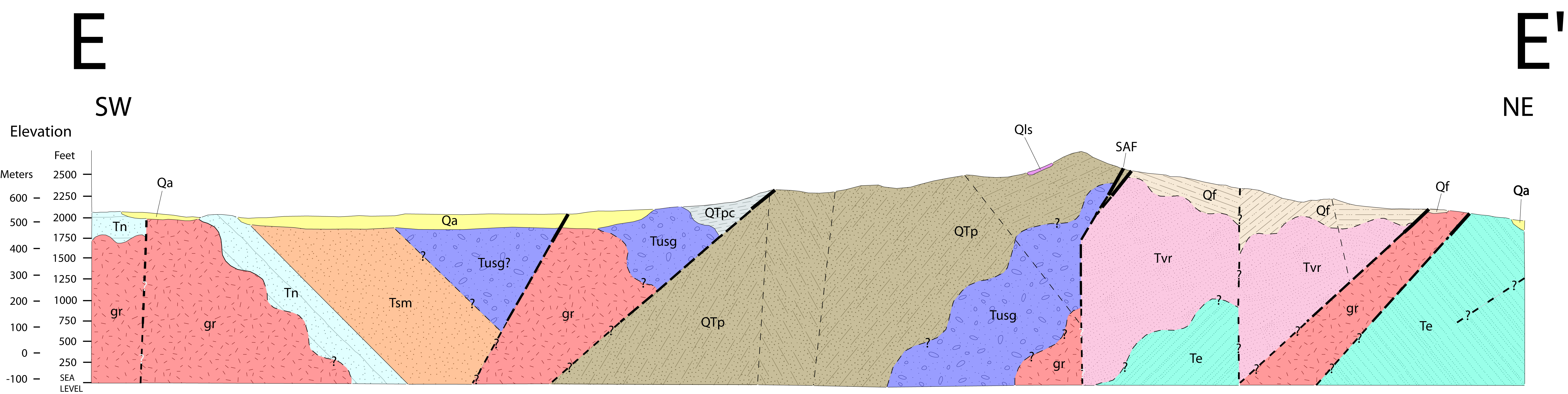
This component of the Parkfield project is focused on characterizing the kilometer-scale geometry of rock bodies and structures and their motions along the San Andreas Fault (SAF) in the vicinity of Parkfield, California. We are working to determine the positions, attitudes, and characteristics of the major rock bodies along the SAF, and to determine the rates of deformation associated with the principal structures of the fault zone.
These studies provide important framework information for existing and proposed geophysical and drilling investigations (San Andreas Fault Zone Observatory at Depth (SAFOD)). Our studies can inform the engineering and drilling effort as well as enhance the interpretations of the coring and measurement projects by providing detailed geological and geomorphic maps and data, and geometric and kinematic models for the SAF at Parkfield.
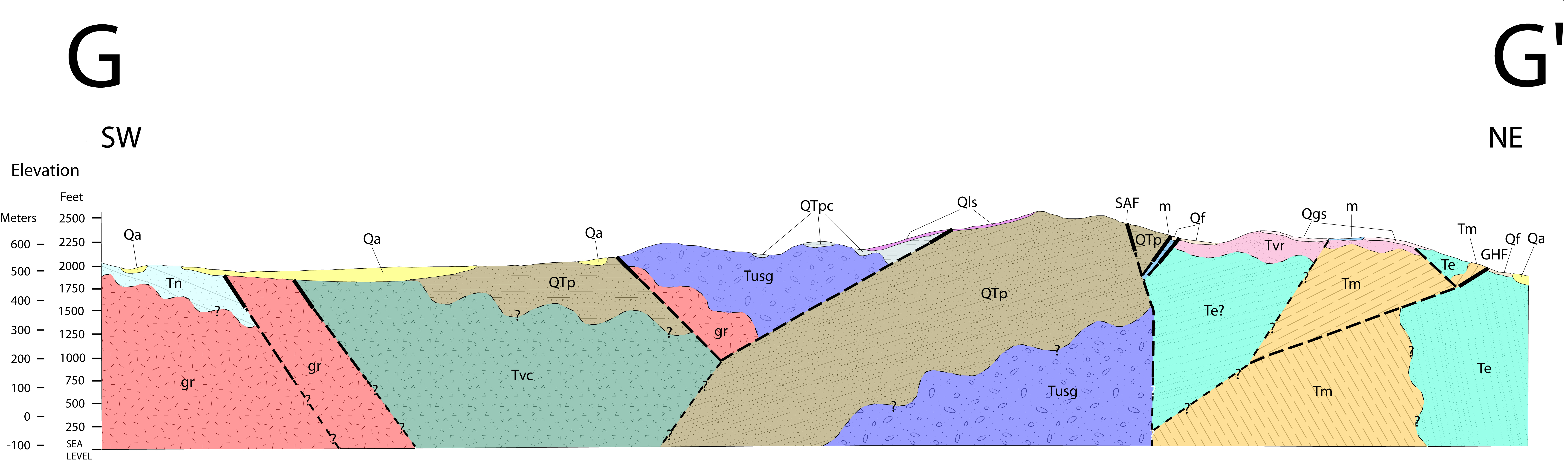
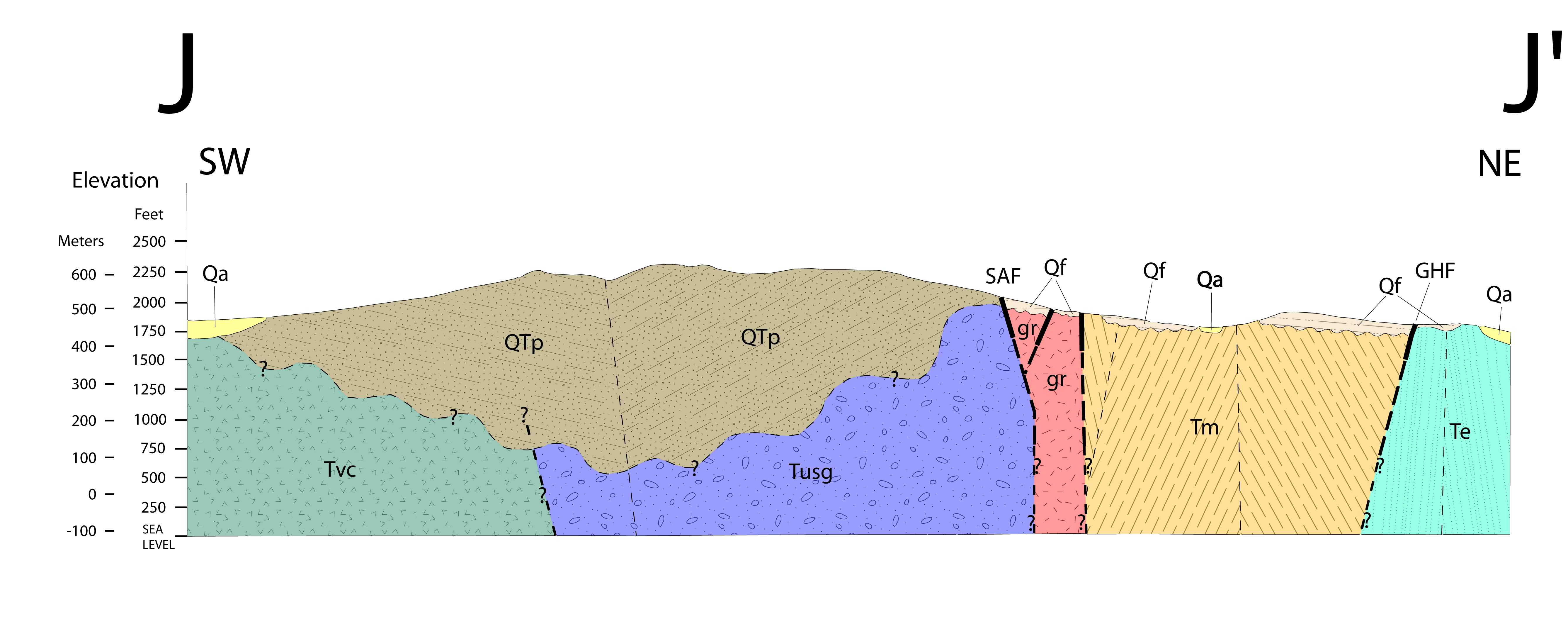
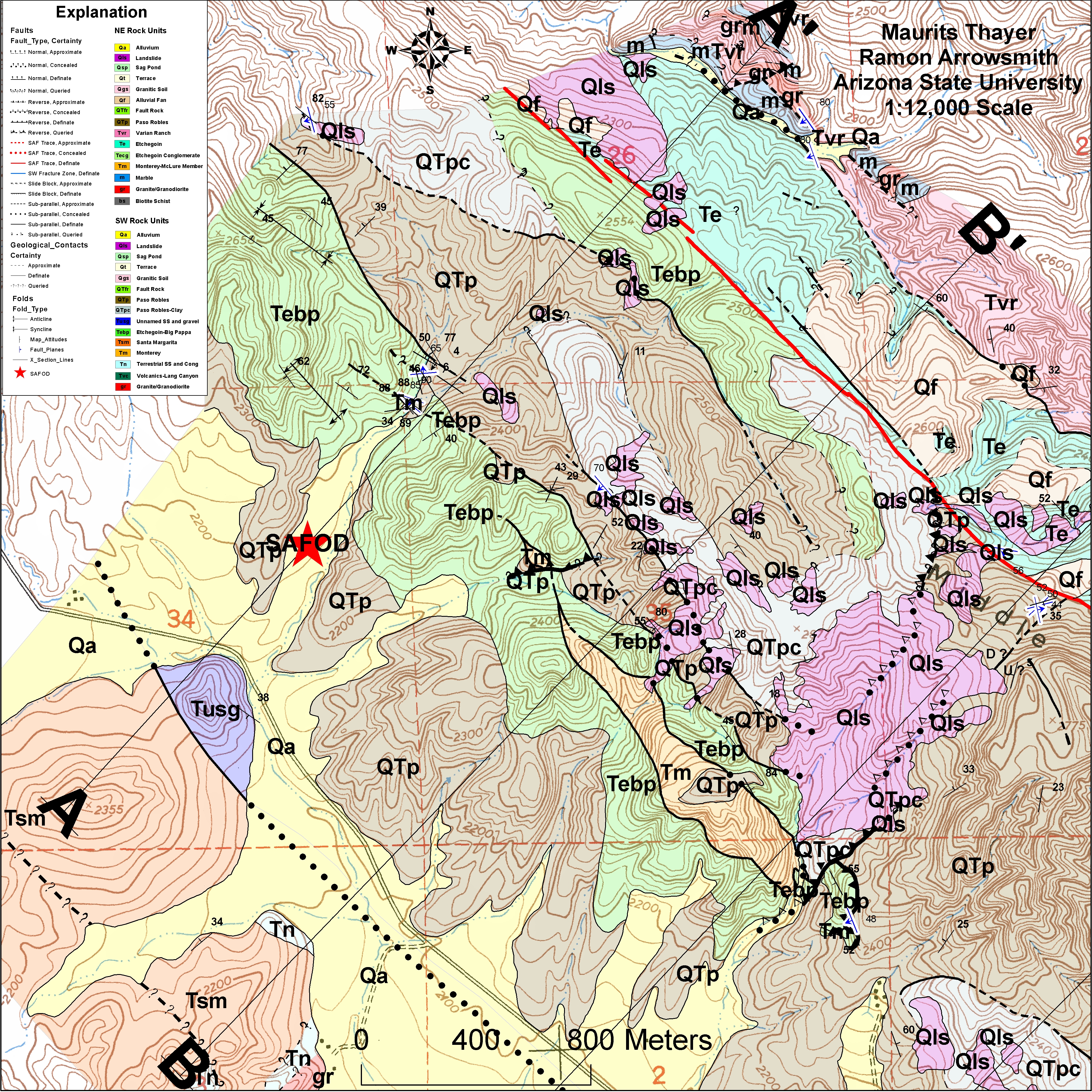
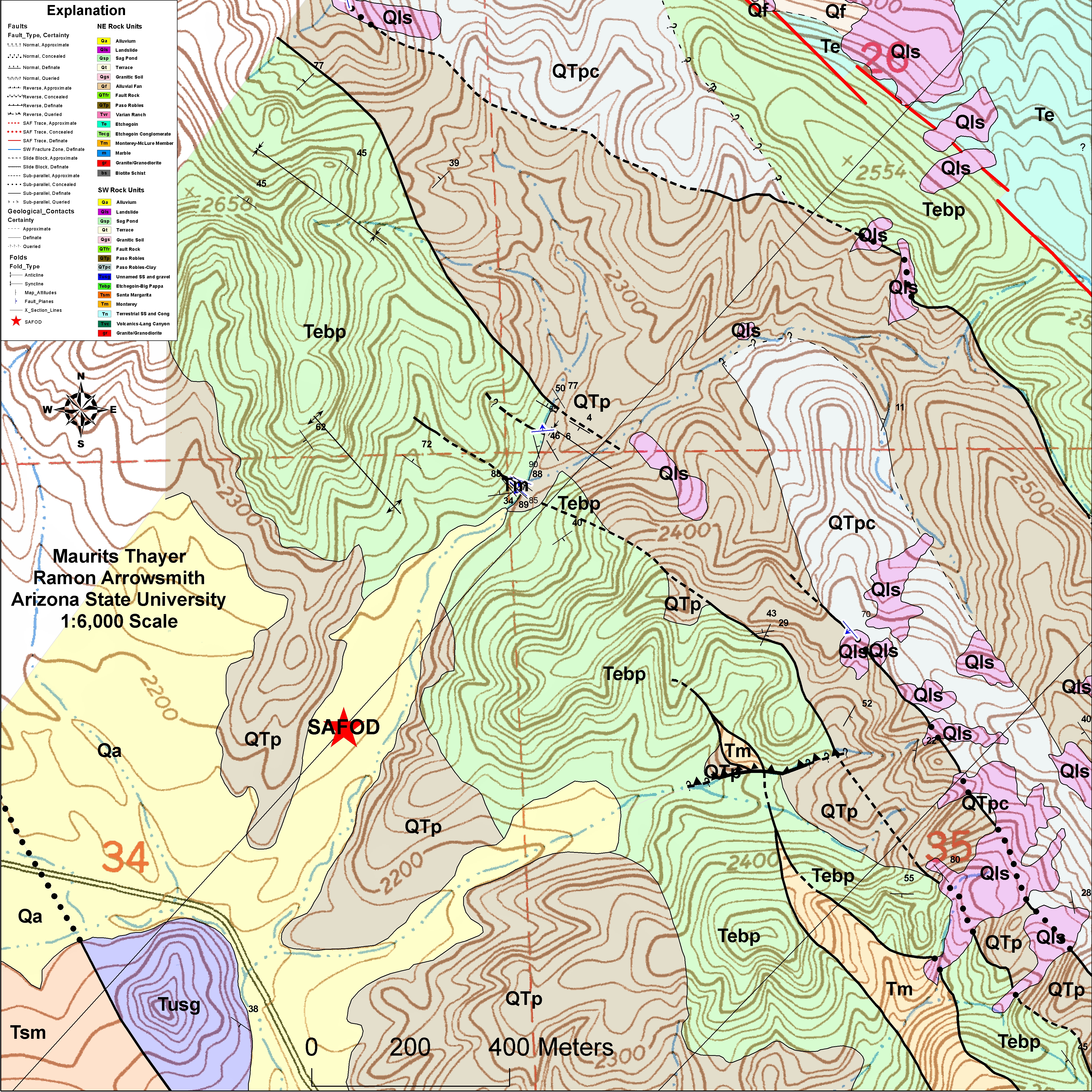
This work is being conducted by Maurits Thayer for his M.S. thesis. The map shown below is the product of an intensive high-resolution geologic mapping effort (1:6000 scale) of the Middle Mountain area (about 40 sq. km). Plate 1: Geologic map of Middle Mountain (219Mb!) Plate 2: Serial cross sections (41Mb) Plate 3: Stratigraphic overview (123Mb) 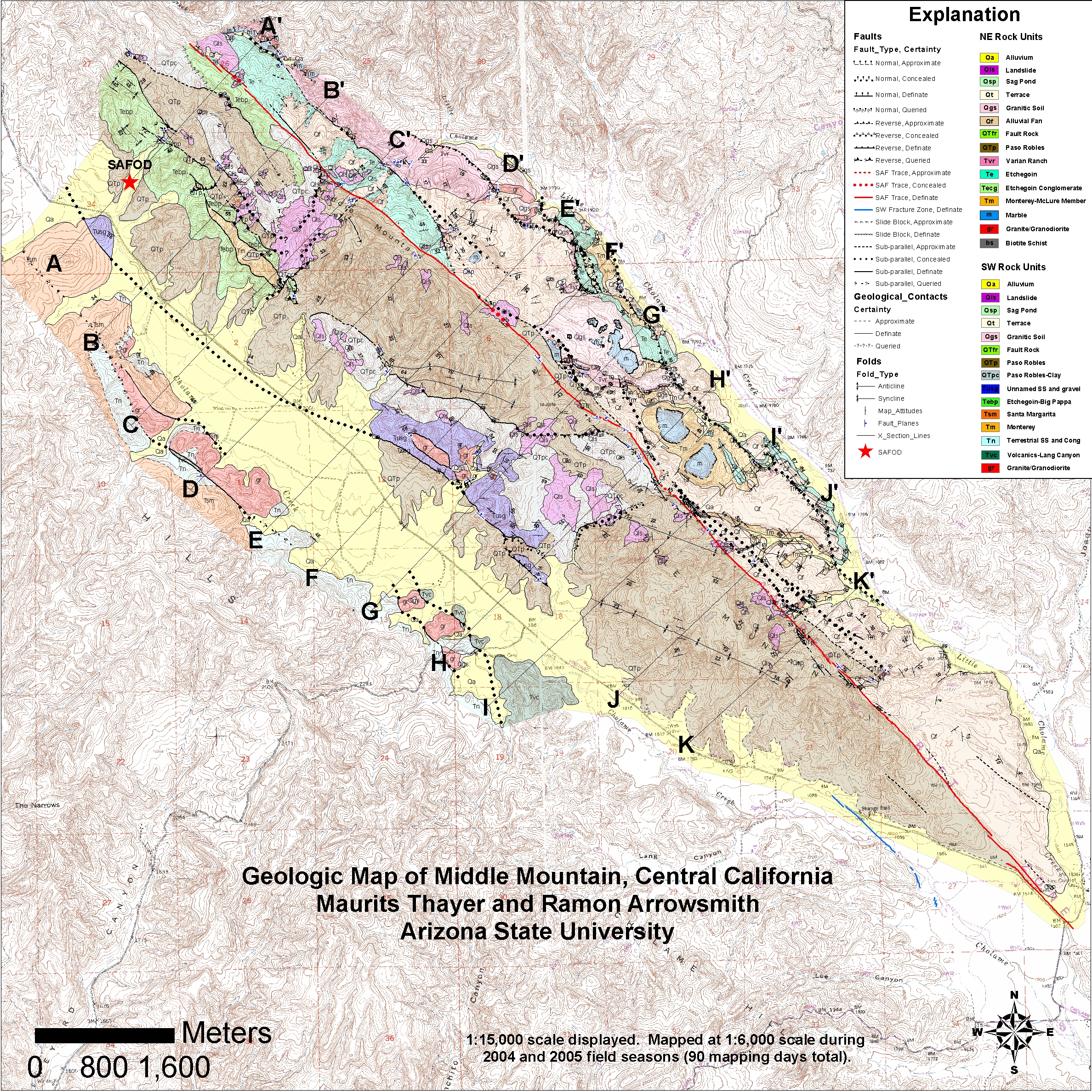 (Click map to view a larger version) CROSS SECTIONS (as marked on the map above): (The following jpeg files are saved at 400 dpi and are 2-3MB each - right click and choose "save image as" to download) A to A' B to B' C to C' D to D' E to E' F to F' G to G' H to H' I to I' J to J' K to K' SAFOD AREA MAPS: (The following jpeg files are aved at 300 dpi and are ~12 MB each - right click and choose "save image as" to download) SAFOD Map SAFOD Map zoomed ABSTRACTS:
Thayer, M.R., Arrowsmith, J R., Young, J. J., Fayon, A., Rymer, M.J., 2004, Geologic structure of Middle Mountain within the San Andreas Fault zone near Parkfield, California, Eos Trans. AGU, 85 (47), Fall Meet. Suppl., Abstract T13A-1335. |
